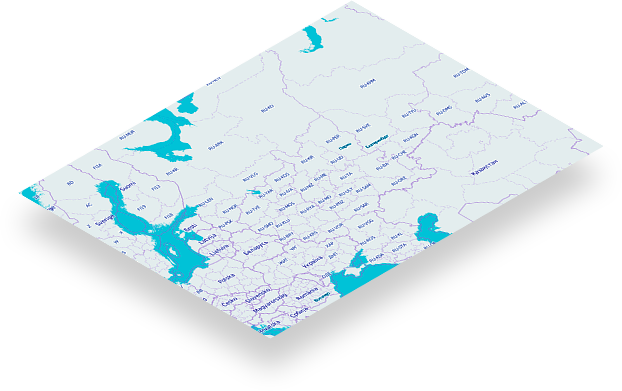
What is digital naksha

Digital Naksha is online platform that allow its users to create, access and interact with diffrent kind of maps over internet. These Platform typically provide features such as:

  • Map Display - Showing Information of Assets features such as Pipeline, Roads, Lands, Electric grid, Gas grid and many more.

  • Map Create Facility - Users can create, upload, edit maps with respective attribute data

  • Zoom and Pan - enabling users to zoom in and out of maps and pan across different areas.

  • Layered Information - Displaying additional information layers, such as satellite imagery, street view and more.

  • Importing Various Types of Data - Users can import Shape File, Kml file, Dxf Files, CSV files and view analyze the data.

  • Querry the data - Users can perfrom Querry, Serch, Rule Base Query on Digital Naksha Portal.

About Us

With over 22 years of expertise, our firm specializes in Survey, Mapping, and GIS services. Our extensive experience spans various industries, including Forest Management, Utilities, Urban Planning, Railways, Ports & Harbors, Infrastructure Development, Education, Revenue Management, and Irrigation. We have successfully executed assignments across diverse landscapes, each varying in nature, magnitude, and scale.

Based upon our extensive experience across multiple industries, we recognize the pressing need for a solution like this product. Integrating evolving technologies, we've developed this offering to address the industry's challenge of accurately mapping assets, a task that has proven increasingly complex

Why digital naksha

Problems

  • Outdated or Incomplete Records

    Infrastructure records may be outdated or incomplete due to changes in asset status, maintenance activities, or lack of proper documentation.

  • Data Silos

    Information may be stored in different systems or departments, leading to data silos that hinder efficient data sharing and collaboration.

  • Lack of Standardization

    Inconsistent data formats and standards across different systems or agencies can make it difficult to integrate and analyze asset information.

  • Limited Technology Adoption

    Some organizations may still rely on manual or outdated systems for managing infrastructure records, hindering the adoption of newer technologies.

Solution

  • Digitalization and Centralized Databases

    Implementing digital record-keeping systems and centralizing databases can help ensure that information is up-to-date, easily accessible, and can be shared across departments.

  • Standardization of Data

    Establishing standardized data formats and protocols for recording and exchanging infrastructure asset information can enhance interoperability and streamline data management.

  • Integration of GIS Technology

    Geographic Information System (GIS) technology can be employed to create spatial databases, allowing for better visualization and analysis of infrastructure assets.

  • IoT and Sensors

    Utilizing Internet of Things (IoT) devices and sensors can provide real-time data on the condition of infrastructure assets, enabling proactive maintenance and reducing downtime.

  • Cloud-Based Solutions

    Cloud computing can offer scalable and flexible solutions for storing and managing infrastructure records, facilitating remote access and collaboration.

  • Data Governance Policies

    Establishing robust data governance policies can ensure data quality, privacy, and compliance with regulations.

Contact us

Name
Phone
Message

Frequently Asked Questions

Digital Naksha Mapping Portal is an online platform that provides access to a comprehensive for mapping and spatial analysis. It offers a range of tools and features to visualize, analyze, and interpret geographic data.

Digital Naksha Mapping Portal stands out for its user-friendly interface, advanced mapping capabilities, and a diverse set of tools for both beginners and experienced GIS users. Our subscription-based model ensures you have access to the latest features and updates.

To subscribe, visit our website and choose a subscription plan that suits your needs. Follow the registration process, select your preferred payment method, and enjoy instant access to our Mapping Portal.

We offer various subscription plans, including annual options. Our plans are designed to cater to individual users, businesses, and organizations with different usage requirements.

Digital Naksha Mapping Portal supports a wide range of spatial data, vector data. You can upload your datasets or explore our extensive library of geographic data layers to create informative and insightful maps.

We take data security seriously. Your data is encrypted during transmission and storage. Our platform complies with industry standards to ensure the confidentiality and integrity of your geographic data.

The subscription plans come with different levels of storage and usage limits. Check the details of each plan to understand the allowances for maps, layers, and storage. You can always upgrade your subscription to accommodate more extensive usage.

Yes, Digital Naksha Mapping Portal allows you to share your maps with others through various collaboration features. You can share maps publicly or restrict access to specific users, ensuring that your work is accessible to the right audience.

Subscribers have access to our customer support team via email or live chat during business hours. Additionally, we provide documentation, tutorials, and webinars to help you make the most of Digital Naksha Mapping Portal.

We regularly update Digital Naksha Mapping Portal with new features, enhancements, and data layers. Subscribers receive automatic access to these updates as part of their subscription.